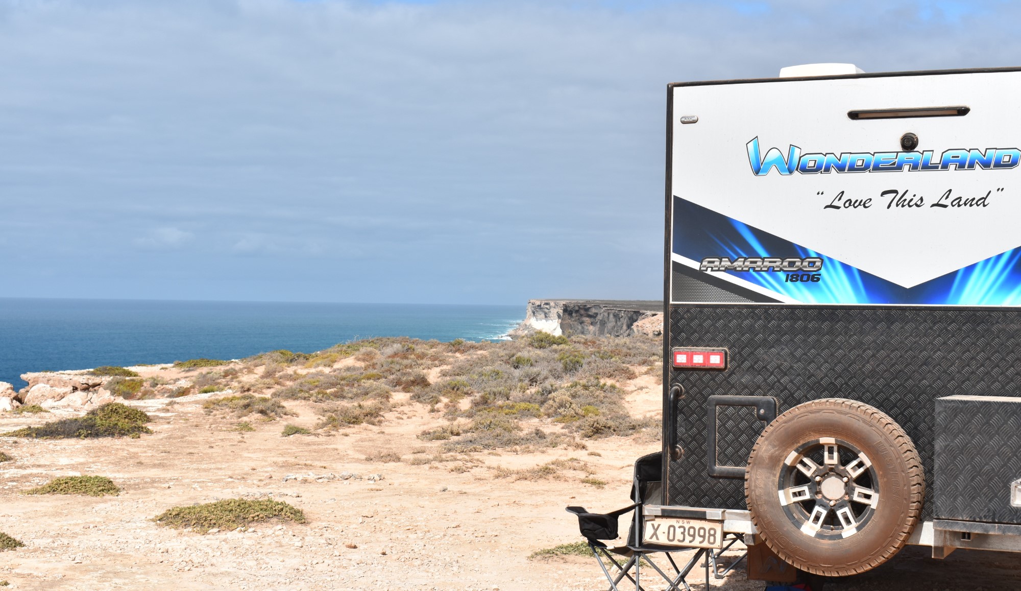
Today is one for a drive. Not too far south of us is Capertee national park. I wanted to come here last time, but it was closed as NPWS were clearing pests. I called up a few days ago and got the gate code so we should be good this time.
We drive most of way back to Kandos, then head south. The road is a hotchpotch, so I’m glad we don’t have the van on. After about 40odd Ks we reach the turnoff to the National Park, Port Macquarie Road of all names! We reach the gate, which Justine unlocks and we head into the park. There is a small camping area here with what seems like a couple of campers. It seems pleasant enough, but nothing special. Cindy mentioned this was a new National Park, and it clear this was farming country up until very recently. We cross the Capertee River a few times, but the water is low and the concrete causeways make it simpler than I hoped!
I’ve read about a track here that leads up to Valley lookout, the Capertee Valley is claimed to be the 2nd Widest in the world (just pipping the Grand Canyon). The 4km 4×4 track is pleasant enough, but the lookout is a little underwhelming. Let’s just say, I‘m glad I didn’t drive from Sydney for this.
We stop for a break and a photo opp, but are soon on our way.


A little further south from here is the small township of Glen Davis and a camping area I’m interested in seeing called Coorongooba. It might be another option for a future camping trip. So back along Port Macquarie Road to the main road. We drive past a few houses that we assume make up Glen Alice and the scenery becomes amazing, what looked to be a rather drab valley back in the National Park has opened up into this massively large valley with escarpment cliff faces in just about every direction. We’re so gobsmacked, I didn’t see a local catch up to us and I quickly pull over for him to pass. “bloody tourists” he must be thinking, and rightly so.

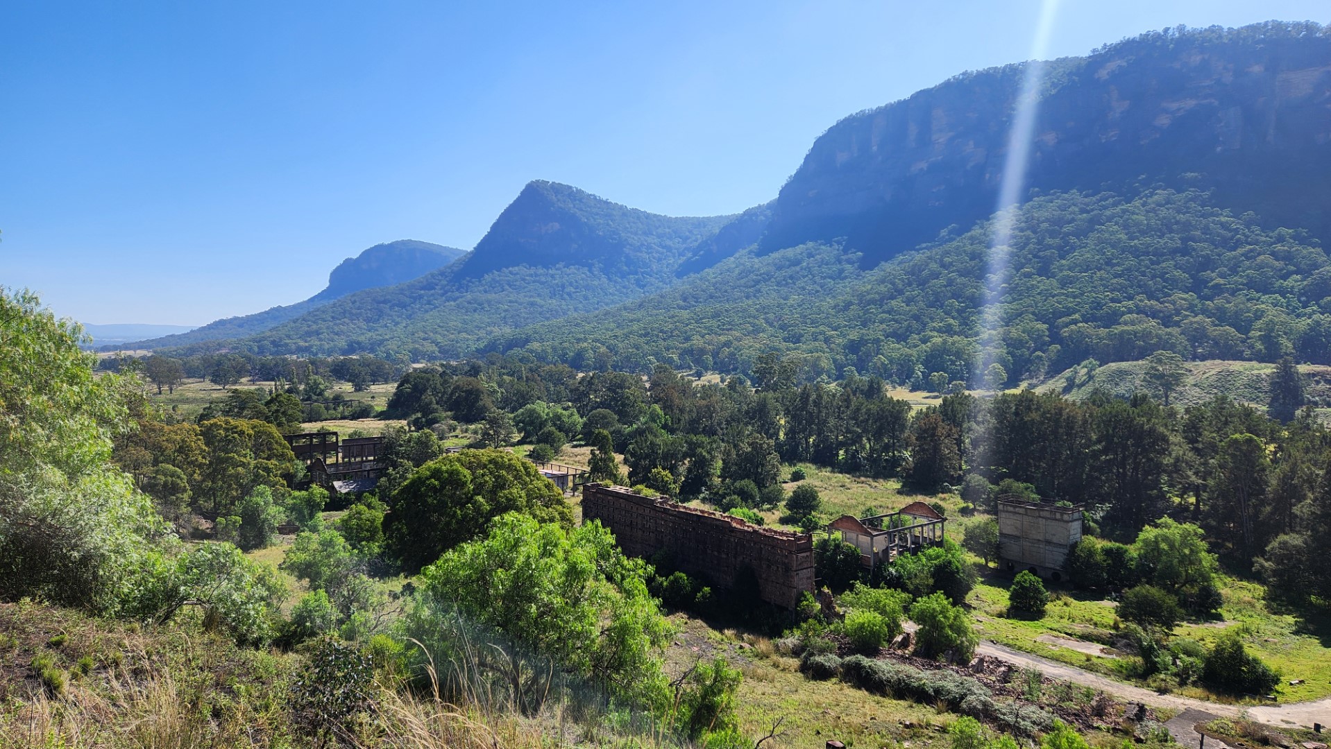
We drive into Glen Davis, it’s only a dozen or so houses and it sure seems like it’s seen better days. Nearby is meant to be the old ruin of a Shale Oil works, but it seems to be on private property and if there are tours still running, they don’t seem to be on today.
We make our way into the campground and we see a walk to a lookout over the plant. The first few hundred meters are up a steep staircase cut into the rock, so it’s a bit hard going. Then it gets easier. The view over the valley and the Shale works is pretty interesting and certainly worth the walk.
Up here there are some other ruined buildings, but these do seem somewhat newer, apparently the place only operated from the 1940 and closed in the early 1950’s

Back to the car and we finally make it to the campground. This is pretty sensational location, in between two huge escarpment faces. We find a nice spot to stop and have some lunch. Having the car fridge certainly makes this easier.

After a bite we take a walk down to the river. It’s more like a large creek, so it’s not that big or deep, although it is running at a bit of a clip. You couldn’t do much more than have a splash in here, well you could if it wasn’t like ice!
Finally, a lap of the main camping area, it looks really nice with heaps of grassed areas, so it might be worth a camping trip sometime.
We make our way home. As the road in was pretty average, we think it might just be as quick to go back to the main Castlereagh Highway and back via Kandos (note….. it wasn’t ☹)
A quick stop in Kandos for some supplies and we make our way back to the campsite.
After a rest, I take the opportunity to go for a kayak, I venture up the small tributary that we’re on, you can only go a few hundred metres before the water becomes blocked with reeds. On the way back I’m nearly blinded by the late afternoon sun, low on the horizon. So I maybe last 40odd min and then I’ve had enough.
A fire and I get another timelapse going, this time with the external battery.
That was a very interesting days outing, enjoyed it immensely.